University of Minnesota
http://www.umn.edu/
612-625-5000
http://www.umn.edu/
612-625-5000
Minnesota Biodiversity Atlas
Bell Museum
Dataset: MIN-Plants
Search Criteria: Canada; British Columbia; Renfrew; excluding cultivated/captive occurrences
1
Page 1, records 1-10 of 10
Bell Museum plants | |
 MIN:Plants | 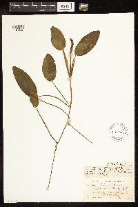 57497[1191462]Rosendahl, C. O. 790 Canada, British Columbia, Renfrew |
MIN:Plants |  Potamogeton pusillus subsp. tenuissimus (Mertens & W.D.J. Koch) R.R. Haynes & Hellquist 57712[1191709]Rosendahl, C. O. 898 Canada, British Columbia, Renfrew |
MIN:Plants |  Veronica americana Schweinitz ex Bentham 190432[1190056]Rosendahl, C. O. 40 Canada, British Columbia, Renfrew |
MIN:Plants |  Veronica serpyllifolia subsp. humifusa (Dicks.) Syme 190784[1190748]Rosendahl, C. O. 818 Canada, British Columbia, Renfrew |
MIN:Plants | 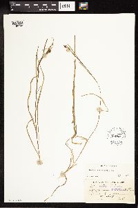 57062[1189746]Rosendahl, C. O. 880 Canada, British Columbia, Renfrew |
MIN:Plants | 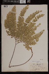 50727[1303316]Rosendahl, C.O. 901901-06-00 Canada, British Columbia, Renfrew, Vancouver Island, 49.666667 -125.833333 |
MIN:Plants | 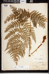 Dryopteris expansa (C. Presl) Fraser-Jenkins & Jermy 52544[1324769]Rosendahl, C.O. 1021901-06-00 Canada, British Columbia, Renfrew, Vancouver Island. District of Renfrew |
MIN:Plants | 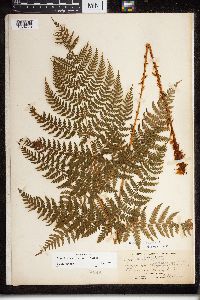 Dryopteris expansa (C. Presl) Fraser-Jenkins & Jermy 52549[1324773]Rosendahl, C.O. 1021901-06-00 Canada, British Columbia, Renfrew, Vancouver Island. District of Renfrew |
MIN:Plants | 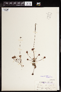 122035[1345803]Rosendahl, C.O. 9271902-08-13 Canada, British Columbia, Renfrew |
MIN:Plants | 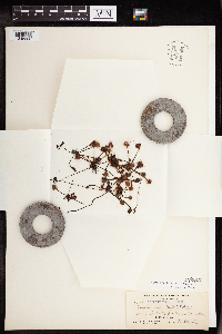 122013[1345806]Rosendahl, C.O. 130 Canada, British Columbia, Renfrew |
1
Page 1, records 1-10 of 10
Google Map
Google Maps is a web mapping service provided by Google that features a map that users can pan (by dragging the mouse) and zoom (by using the mouse wheel). Collection points are displayed as colored markers that when clicked on, displays the full information for that collection. When multiple species are queried (separated by semi-colons), different colored markers denote each individual species.